
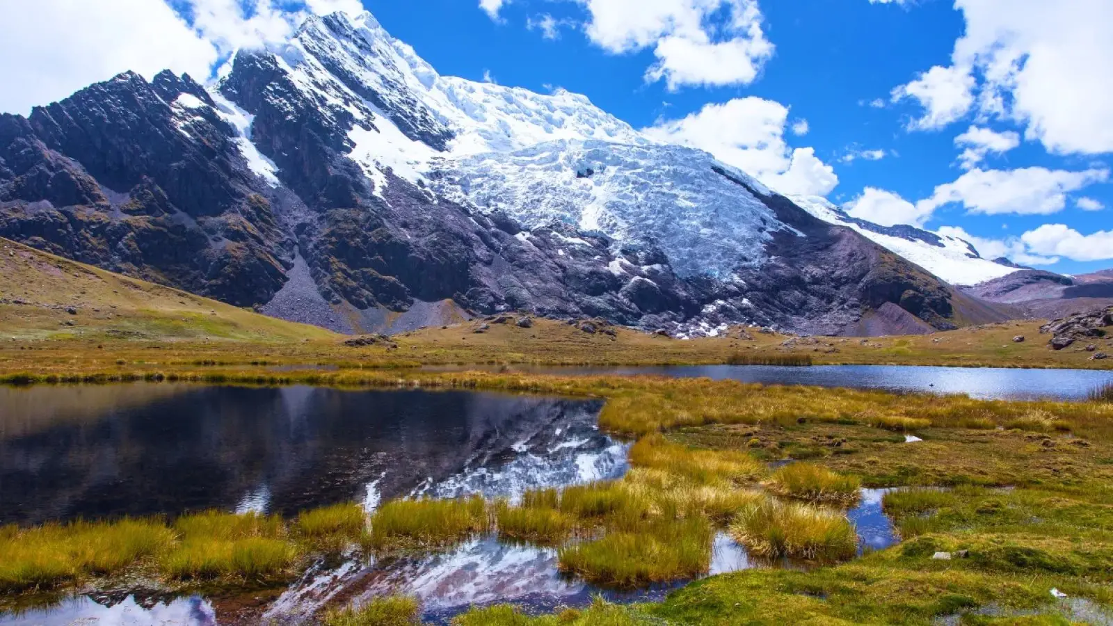
Short answer: The Ausangate 7 Lakes is a one-day loop hike from Pacchanta, a herding community in Ocongate district (Quispicanchi province) at the foot of Ausangate, the highest mountain in the Cusco region. From Cusco you drive the Interoceanic Highway via Urcos, Ocongate and Tinki in approx. 3 to 4.5 hours, and the loop of roughly 10 to 13 km takes approx. 4 to 5 hours, always above 4,200 m (13,780 ft). You can go on a shared tour, on your own or with a private driver: a private Ausangate day trip from Cusco with Viajes D’MARC costs from US$114 (S/ 400) per vehicle, with hotel pick-up.
What the Ausangate 7 Lakes are
Ausangate (approx. 6,384 m / 20,945 ft) is the highest peak in the Cusco region and in the Vilcanota range, and the most revered apu, or sacred mountain, of the southern Andes: the Qoyllur Rit’i pilgrimage takes place on its slopes. Its glaciers feed a chain of lakes in the valley above Pacchanta, and seven of them make up the hike that agencies sell as the “7 Lakes of Ausangate” or “Ausangate full day”.
The lakes change color with the minerals in the ground, their depth and the light: turquoise, green, deep blue and reddish shores. Their Quechua names describe them; the most commonly cited are:
- Pucacocha (red lake), named for its reddish surroundings.
- Q’omercocha (green lake).
- Azulcocha or Anqasqocha (blue lake).
- The two Uturunkuqocha or Otorongo lakes (jaguar lake), known as male and female.
- Alqacocha and Patacocha, which complete the circuit according to many guides.
Names and order vary between guides. The real draw is walking among glaciers, wetlands full of alpacas and herders’ homes, with far fewer visitors than at Rainbow Mountain.
Where it is and how to get there from Cusco
Pacchanta lies approx. 120 km southeast of Cusco. The road follows the Vilcanota valley to Urcos, where it joins the Interoceanic Highway and climbs across the high plateau to Ocongate and Tinki (about 3,800 m). At Tinki the asphalt ends and a dirt road of approx. 30 minutes leads to Pacchanta. Allow approx. 3 to 4.5 hours each way depending on the vehicle, stops and the state of the last stretch, and a full day of 12 to 14 hours.
Shared tour
Many agencies in central Cusco sell the “Ausangate full day”: pre-dawn pick-up, breakfast on the way, a guided hike, lunch in Pacchanta and back in Cusco at night. It is the cheapest option per person, but the group walks at the pace of the slowest member and time at the lakes and hot springs is fixed. Ask whether the community fee and the hot springs are included.
Private transport
A vehicle and driver just for your group: you are picked up at your hotel at the time you choose and the driver waits in Pacchanta while you hike. You can stop for breakfast in Ocongate, leave dry clothes and food in the vehicle and decide on the day whether to use the hot springs. The price is per vehicle, which suits couples, families and groups. This is our private Ausangate 7 Lakes tour; if you do not know the trail, ask for a local guide on WhatsApp when you book.
On your own
Buses and colectivos leave Cusco for Ocongate and Tinki (approx. 2.5 to 3 hours; ask at your hostel for the current departure point, as it moves). In Tinki you hire a taxi or local car to Pacchanta and agree a return time. It is the cheapest way, but very tight in one day, so many hikers spend the night in Tinki or Pacchanta. The trail is not always marked, so carry an offline map.
| Option | Leaves Cusco | Pros | Cons | Best for |
|---|---|---|---|---|
| Shared tour | Fixed time, before dawn | Low price per person, guide and meals | Large group, rigid schedule | Solo travelers on a budget |
| Private transport | Whenever you choose | Hotel pick-up, your pace, vehicle waiting for you | Price is per vehicle; guide extra | Couples, families and groups |
| On your own | Depends on buses to Tinki | Cheapest | Changes, little daylight margin, unmarked trail | Backpackers who can stay overnight |
The 7 Lakes Ausangate hike step by step
It is a loop that starts and ends in Pacchanta, and most people walk it clockwise. Published distances range from about 10 to 13 km depending on the variant, with approx. 4 to 5 hours of walking including stops.
- Arrive in Pacchanta (approx. 4,200–4,300 m). Pay the access fee charged by the community: it sets the amount and it can change, so bring cash in soles. Adjust your layers, as early mornings are usually below freezing.
- Decide on a horse. Locals often offer horses for part of the route. It is optional and paid directly; agree the price and the distance before you get on.
- Climb to the first lakes. Approx. 1.5 hours of steady uphill through the valley, past wetlands and alpaca herds, with Ausangate straight ahead.
- The lakes circuit. You pass Pucacocha, Q’omercocha, the Uturunkuqocha lakes and Azulcocha, among others, with ups and downs on herders’ paths. The high point is around 4,600 to 4,800 m (15,100–15,750 ft) depending on the variant, and you will feel it.
- Descent to Pacchanta. The last section drops down the valley, sometimes muddy or with loose stones. Then the hot springs and back to Cusco from mid-afternoon.
The Pacchanta hot springs
Next to the village are small, simple hot spring pools facing the mountain, paid separately with a small fee on site. Bring a swimsuit, towel and sandals, dry off well before getting out (the air is icy) and do not stay in too long if you feel dizzy.
Altitude, difficulty and acclimatization
Cusco sits at about 3,400 m (11,150 ft); on this hike you spend several hours between approx. 4,200 and 4,800 m. There are no technical sections, but distance, altitude and cold together make it demanding: it is longer than Humantay or Rainbow Mountain and needs good fitness.
- Acclimatize for at least 2 days in Cusco or the Sacred Valley and, if you can, do a shorter hike such as Humantay Lake first.
- Warning signs: a strong headache, nausea, dizziness, breathlessness at rest or confusion. Stop and head back to Pacchanta; symptoms usually ease as you descend. More in our guide to altitude sickness in Cusco.
- See your doctor first if you have heart or breathing conditions, high blood pressure or are pregnant.
- Remote area: phone signal is patchy and the nearest medical care is in the towns along the highway. Do not hike alone.
Ausangate 7 Lakes vs Humantay vs Rainbow Mountain
These are the three most requested high-mountain hikes from Cusco. This comparison helps you choose:
| Ausangate 7 Lakes | Humantay Lake | Rainbow Mountain | |
|---|---|---|---|
| Approx. high point | 4,600–4,800 m | 4,200 m | 5,000 m (viewpoint) |
| Drive from Cusco (approx.) | 3 to 4.5 h | 3 to 3.5 h | 3 h |
| Hike | 10–13 km loop, 4–5 h | 1.5–2 h steep climb | 1.5–2 h climb, steep finish |
| Difficulty | Longest and most sustained | Short but steep | Highest altitude |
| Crowds | Few | Many | Many |
| Bonus | Hot springs and a herding village | Views of Salkantay | Views of Ausangate |
If this is your first high-altitude hike, start with Humantay Lake. For colorful mountains with less effort, Palcoyo is gentler than Rainbow Mountain (Vinicunca). Ausangate is for acclimatized hikers looking for solitude and real high-mountain scenery.
Best time to go and what to bring
When to go
- May to September (dry season): blue skies, a clear view of the peak and a dry trail, with nights and early mornings below freezing.
- April, October and November (shoulder months): a good balance of weather and views; afternoon showers are possible.
- December to March (rainy season): mud, fog and sometimes snow or hail that hide the mountain and make the trail harder.
At this altitude it can snow in any month, and mornings are usually clearer than afternoons. More in our guide to the best time to visit Cusco.
What to bring
- Waterproof hiking boots and trekking poles.
- Layers: thermal base, fleece, waterproof jacket, warm hat and gloves.
- Sunglasses, high-factor sunscreen and lip balm: UV is intense up here.
- At least 1.5 liters of water and food for the day: there are no shops on the trail.
- Swimsuit, towel and sandals for the hot springs.
- Cash in soles, in small notes, for the access fee, hot springs, a horse and meals. Do not count on ATMs or card payments.
The full list is in our guide to what to pack for Cusco.
Tips and mistakes to avoid
- Doing it in your first days in Cusco: it is the longest sustained high-altitude hike on this list, so save it for the end of your trip.
- Doing Rainbow Mountain the next day: leave a rest day between two high-altitude hikes.
- Leaving Cusco late: clouds usually build in the afternoon and the light goes early in the valley.
- Getting on a horse before agreeing the price and how far it takes you.
- Entering corrals or photographing people without asking: this is community land. Carry your trash out.
- Booking informal transport: on the Interoceanic Highway and the dirt road, who drives and in what vehicle matters. More advice in our guide to staying safe in Cusco.
Why trust this guide
It is written by the local drivers of Viajes D’MARC, who have driven the roads around Cusco every day since 2010 and take travelers to Pacchanta: we know the dirt road from Tinki, how long the day really takes and how the mountain changes with the seasons. Updated November 2026. Third-party fees and conditions change: confirm them on site.
Frequently asked questions
Where are the Ausangate 7 Lakes?
In the community of Pacchanta, Ocongate district, Quispicanchi province, approx. 120 km southeast of Cusco. You drive the Interoceanic Highway to Tinki and then a dirt road of about 30 minutes.
How long is the 7 Lakes Ausangate hike?
Approx. 4 to 5 hours for a loop of 10 to 13 km, depending on the variant and your pace. Including the drive there and back, the whole day lasts around 12 to 14 hours.
How high are the Ausangate 7 Lakes?
Pacchanta is at about 4,200–4,300 m (13,780–14,100 ft) and the high point of the loop is around 4,600–4,800 m, depending on the variant. Ausangate itself rises above 6,300 m.
How much is the entrance fee?
The community charges an access fee and the hot springs are paid separately. Amounts change, so confirm them on site and bring cash in soles. Neither is included in the Viajes D’MARC private tour.
Is it harder than Rainbow Mountain?
It is longer. Vinicunca goes higher on one specific climb, while at Ausangate you spend several hours above 4,200 m with ups and downs. You need good fitness and proper acclimatization.
How much is a private Ausangate day trip from Cusco?
With Viajes D’MARC, from US$114 (S/ 400) per vehicle, not per person, with hotel pick-up and a driver who waits for you. The access fee, hot springs, meals and horses are paid on site; a guide is optional, just ask on WhatsApp.